The Eclipse system displays latitude and longitude for addresses in the Eclipse window and uses an interactive map to let you see the location and change it. Set up this feature in the Map Settings section of the API Configurations window.
Eclipse uses a built-in utility that converts addresses in Eclipse into geographic coordinates (latitude and longitude) in a process called geocoding. The geocoding feature is present in the Customer Maintenance, Sales Order Entry (ship to), Vendor Maintenance, and Contact Maintenance windows. You can also use the Eclipse utility for reverse geocoding to convert the latitude and longitude coordinates into an address. The Eclipse geocoding utility allows you to accurately determine a customer location for shipping and other reasons.
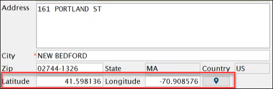
Depending on how you have configured the Map Settings options, the Eclipse system can automatically provide the address's geographic coordinates in the Latitude and Longitude fields.
The Eclipse geocoding system is designed to use an interactive map. When you select the map location icon that is next to the Latitude and Longitude fields, you can see the address location on an interactive map. You also have the option to change the location using the map.
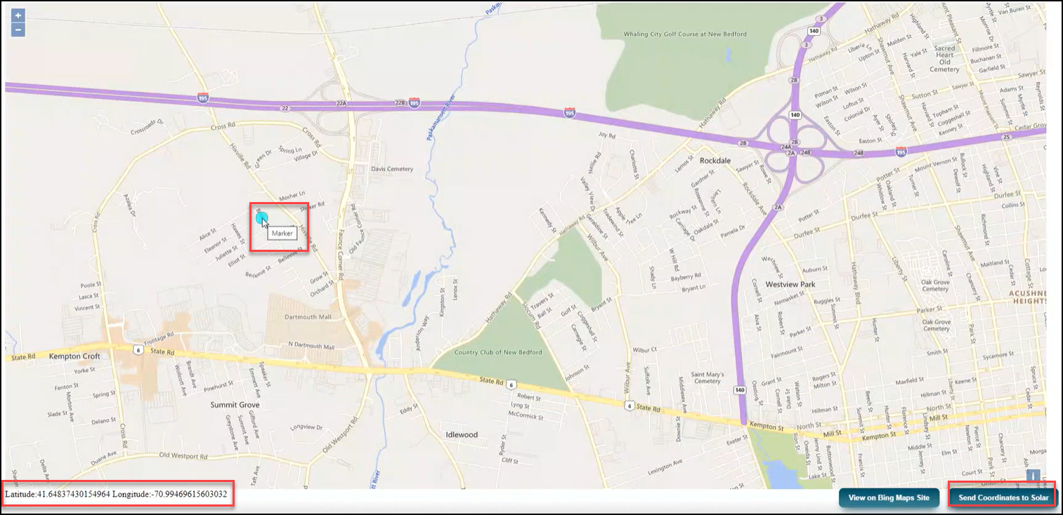
For example, you can select a new location on the interactive map and have Eclipse automatically enter the coordinates in the Latitude and Longitude fields. Then the system can automatically update the address based on the new coordinates.
The following steps for using the interactive map assumes that you have the Map Settings configured to prompt you to confirm the update to the coordinates and the address.
Use the interactive map to edit or update the coordinates and address of an existing customer as follows.
Open the Eclipse window and
enter the appropriate information to display the record.
The system displays the system record with the address.
Note: The record may or may not have the geographic coordinates already populated in the Latitude and Longitude fields.
Select the map location icon. The system displays the Eclipse interactive map with the address marked on the map.
Note: Be aware that the address that the map service found may not be the exact address in the Eclipse system. The map service locates a point as close to the address as possible.
On the map, either click a new location or do not make any change.
Note: Do not make a location change on the map if you only want to view the location on the map or if you want to use the coordinates found my the map service to populate the Latitude and Longitude fields.
Select the Send
Coordinates to Solar button to update the coordinates in Eclipse.
The system displays the message, Do
you want to update the coordinates?
Select OK.
The system updates the Latitude
and Longitude fields and displays
the message, Do you want to update
the Address as well?
Note: Be aware that accepting to update the address may change the address in the Eclipse window, even if you did not select a different map location. The location found by the map service is as close to the address as possible. The address is updated based on the coordinates.
Select OK.
The system updates the address based on the Latitude and Longitude
fields.
Save your changes.